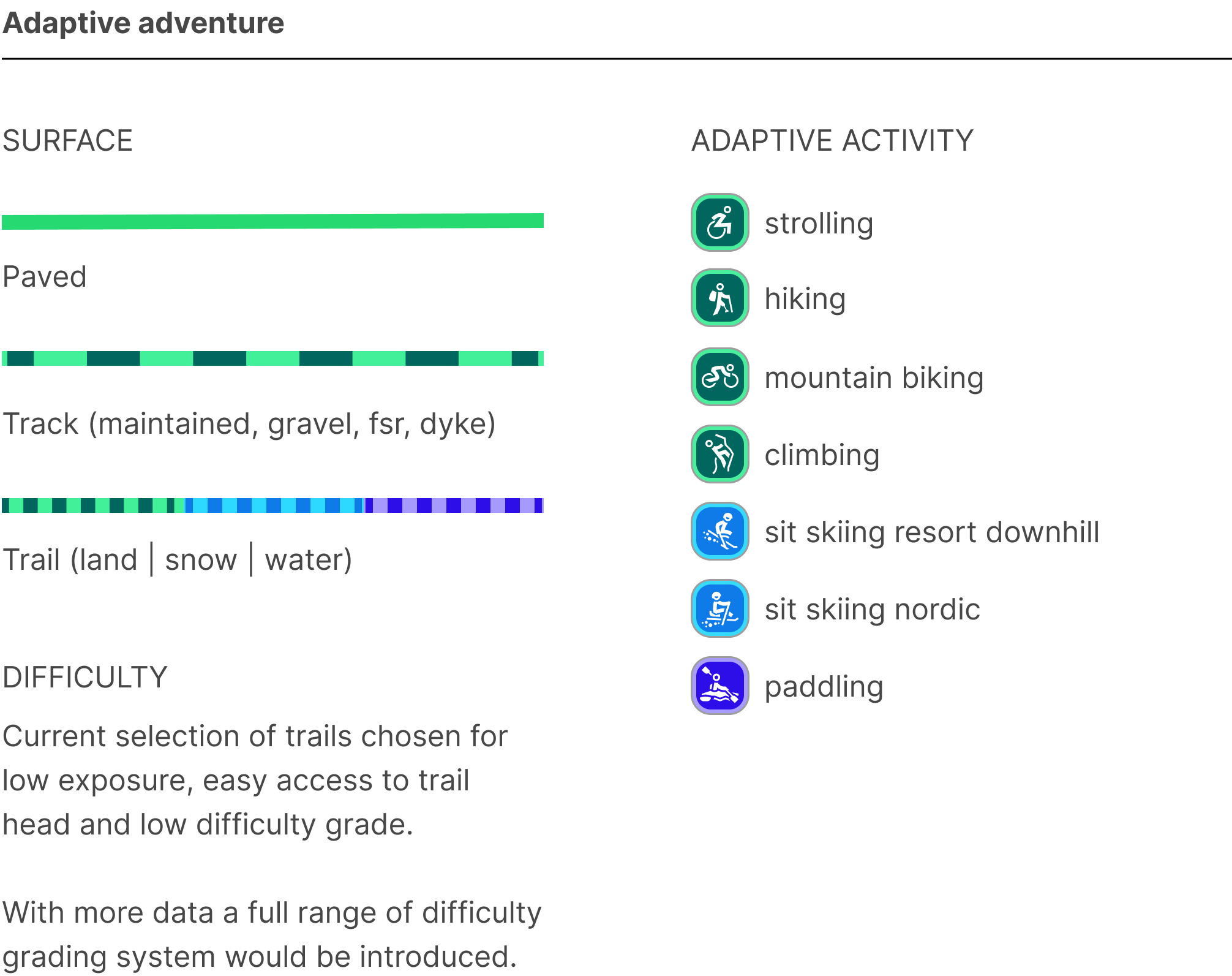
Adaptive maps work with a customized outdoor base map from Mapbox and integrate a curated local dataset and specialized styling tailored to adaptive adventure and downtown accessibility in the Sea to Sky region of British Columbia, Canada.
This map is work in progress and a starting point for conversations, gauging interest and gathering user feedback.
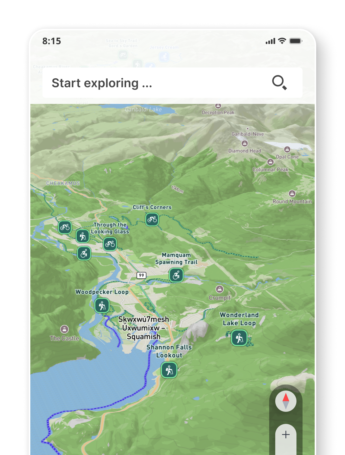
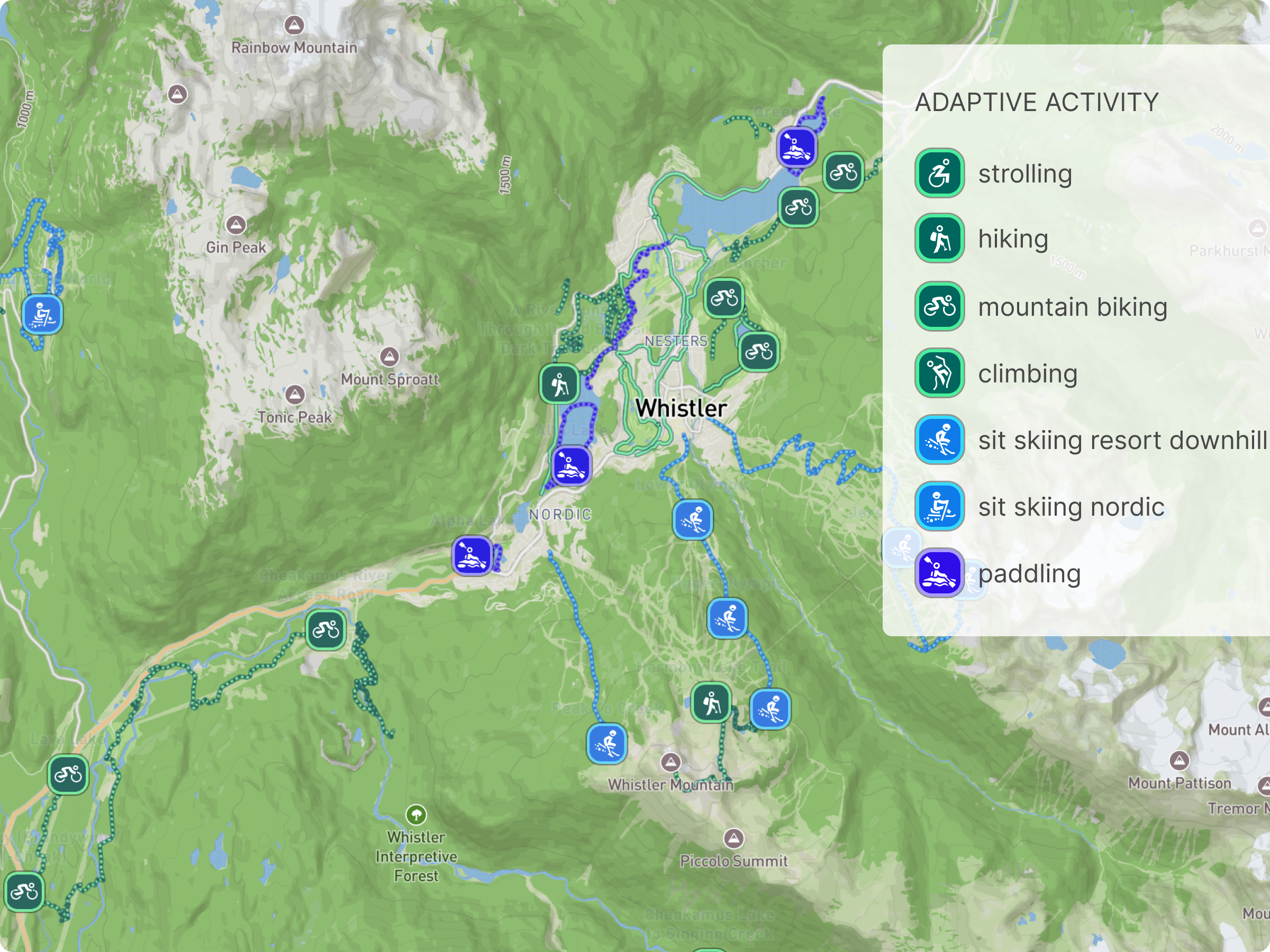
The most popular and accessible adventures on land, snow and water including adaptive hand cycling, sit skiing and paddling.

Interactive adventures (coming soon) - reviewed and recommended by adaptive riders and adventurers.

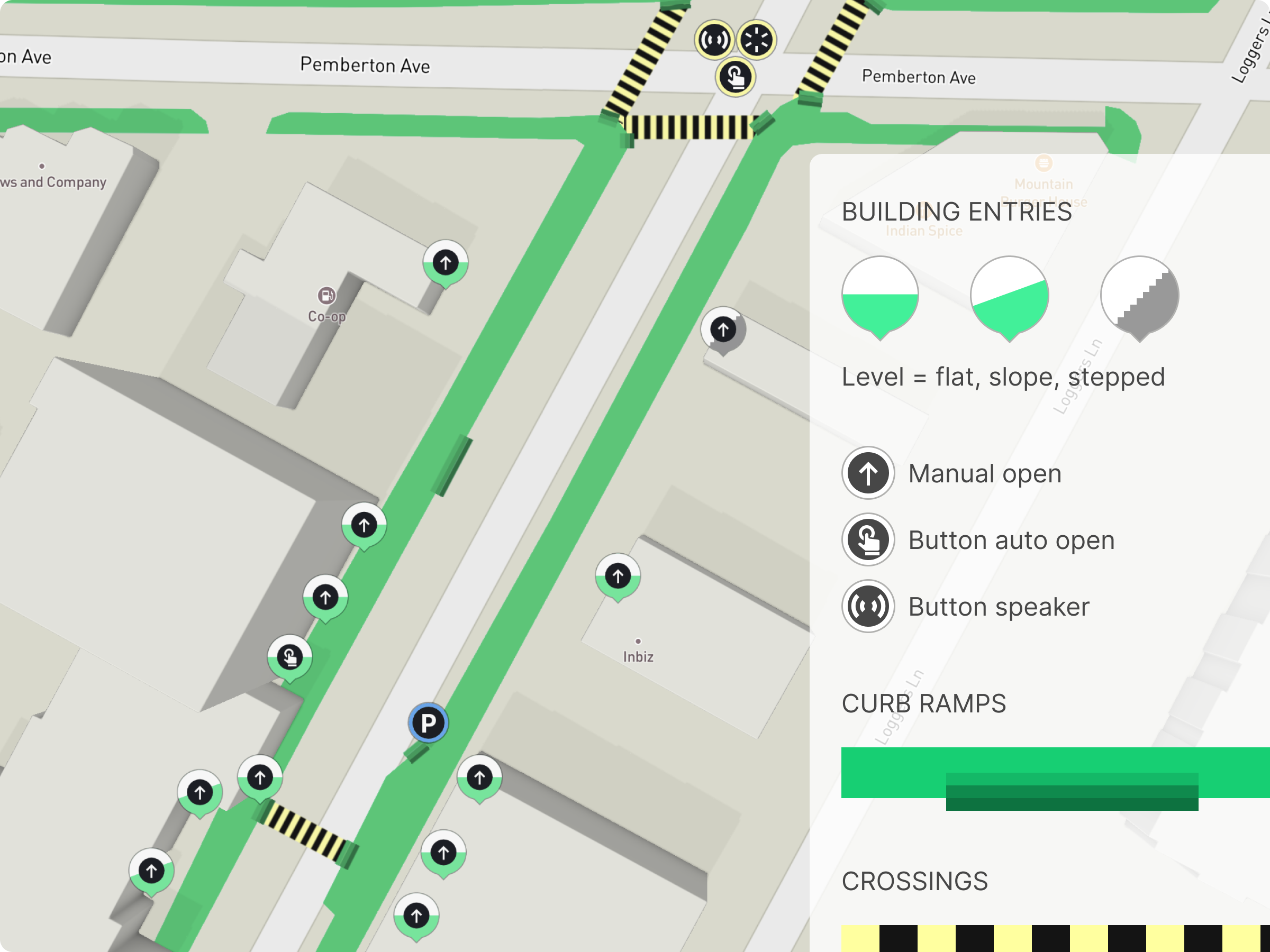
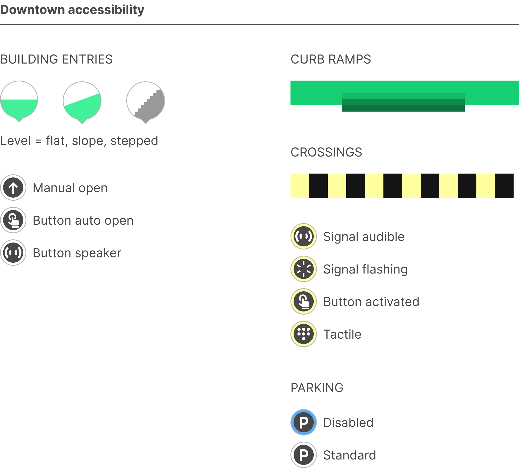
Aim is to give the confidence to move around downtown with more detailed insight into building entry, (later building interior accessibility e.g. washrooms), crossing and sidewalk accessibility. Currently showing a small sample of data for Cleveland Avenue, Squamish.
-> Zoom and pan to explore a sample collection of adventures across Whistler and Squamish. Note only one of these is a clickable example.
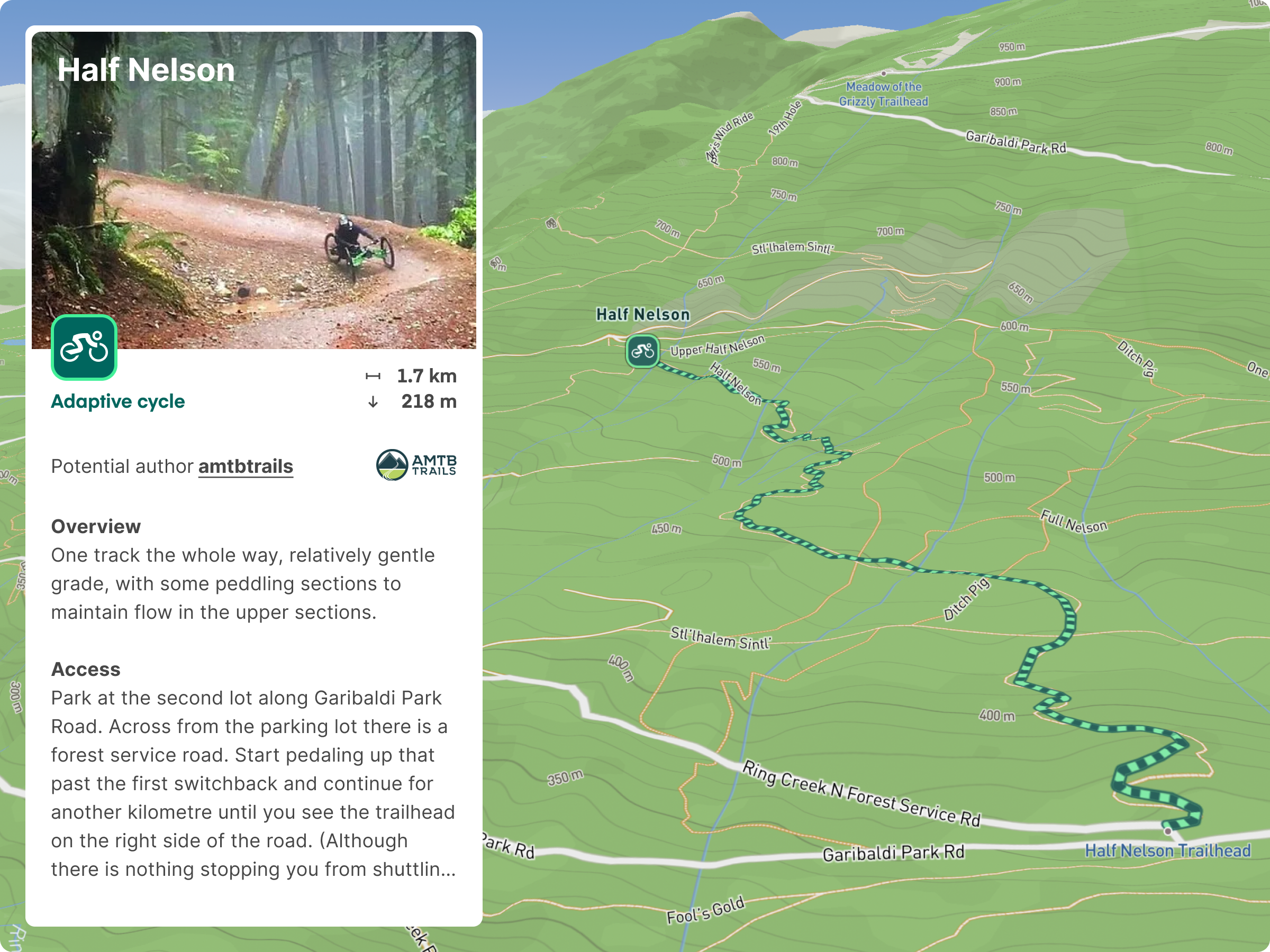
-> Test the clickable adventure – head to Squamish and click on the Half Nelson trail icon (farthest eastern mountain biking trail, just past Quest University).
-> Zoom in closer downtown Squamish (search 'Cleveland Avenue') to view a first collection of accessibility data for buildings, sidewalks and crossings.


Share your thoughts, suggestions, and experiences with us through the form below.
Made with the Webflow CMS and Mapbox. Using Corey Moen's cloneable and Loom tutorial. Some trail data sourced from: Trailforks and All Trails